
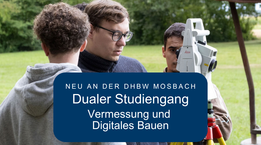
Surveying Meets Digital Construction: A New Dual Degree Program for the Future of Geodesy
Surveying is becoming more digital—and as a result, the requirements for future engineers are changing as well. With the new dual Bachelor’s program in “Surveying and Digital Construction” (subject to accreditation) at the DHBW Mosbach Starting in the 2027–2028 winter semester, a new program will be launched that combines geodesy, digital technologies, and hands-on project experience.
For us at Hemminger, this degree program is particularly important, as we are looking for qualified young engineers, and Managing Director Thomas Nußbaum has been working for several years to create additional dual-track degree opportunities in surveying.
Why We Advocate for a Dual Degree Program in Surveying
Today, modern surveying involves much more than simply recording individual measurement points. In construction, energy, and infrastructure projects, surveying data is used to create digital as-built information, 3D models, and geodata, which are then incorporated into further planning and construction processes.
As a result, the demand for skilled workers who Traditional surveying knowledge combined with digital skills connect.
Thomas Nußbaum has therefore been active for several years on an advisory committee of the HFT Stuttgart for the further development of relevant academic programs. With the new degree program at the DHBW Mosbach A dual program is now being developed that capitalizes on this very connection.
For young people, this means: Study, gain professional experience at the same time, and earn money while you're still in school.
What can you expect from your degree program?
The Degree Program "Surveying and Digital Construction" combines topics from geodesy, geoinformatics, and digitization in the construction industry. These are supplemented by, among other things, project management as well as the fundamentals of business administration and law.
The program lasts six semesters and concludes with Bachelor of Engineering (B.Eng.). The two areas of specialization are as follows: Engineering Surveying and Public Surveying.
The curriculum includes, for example:
- Geodetic Surveying and Computational Methods,
- Geographic Information Systems and Geodata Management,
- CAD and Building Information Modeling,
- Statistics and Equalization Calculations,
- Project Management,
- Quality and Data Management.
The Engineering Surveying track covers, among other things, Applied construction surveying, infrastructure planning, structural engineering, and railway surveying in addition.
Practical application also plays an important role even at the university level. Extensive laboratory exercises are designed to familiarize students with the latest surveying hardware and software; BIM is intended to be an important component of the curriculum.
Study, work, and gain professional experience
The main difference from a traditional full-time degree program lies in the dual model.
At the DHBW, approximately three-month-long Theoretical courses at the university with Practical Training Periods with the Dual Education Partner . Theory and professional practice are explicitly intertwined.
Throughout their studies, dual-track students receive compensation from their dual-track partner.
This means that instead of spending several years just learning theory, you’ll be able to immediately apply what you’ve learned in college to real-world projects—and at the same time discover which areas of geodesy you’re particularly good at.
And what might the practice look like at Hemminger?
This is exactly where the dual study program becomes particularly interesting for us.
At Hemminger, many of the topics covered in the new degree program are already being applied in real-world projects. For example, our teams are working on Construction and infrastructure projects involve surveying buildings and facilities using modern surveying technology and processing spatial information into digital as-built and 3D data.
For dual-track students, this means the opportunity to get to know different aspects of the profession: working on-site on a project, collecting data digitally, and then processing and utilizing the data that has been collected.
This allows participants to experience firsthand how knowledge of measurement technology, GIS, BIM, or data management translates into a concrete project outcome.
And a dual degree program has yet another advantage: the university and the company support you over the course of several years. This allows you not only to learn about a profession, but also to explore potential future career paths, get to know your colleagues, and understand how a company operates.
Perhaps this will allow you to find, even while you're still in school, an employer with whom you'd like to continue your career after earning your bachelor's degree.
The Next Generation for an Industry in Transition
With this new program, the DHBW hopes to inspire more young people to pursue a career in surveying and attract more aspiring female and male engineers to the job market.
We expressly support this goal.
Because no matter how much technology advances, one thing remains crucial: We need people who understand, how the real world is accurately mapped and how this information is used to create reliable digital foundations for construction, energy, and infrastructure projects.
To that end, the new dual degree program combines traditional geodesy with the digital demands of tomorrow.
Interested in a dual degree program?
You're interested in Surveying, Geodata, and Digital Construction and would you like to combine your studies with hands-on project experience?
Then feel free to contact us. We welcome applications and will be happy to tell you about the opportunities for a dual degree program and the practical training phases at Hemminger.